You are designing a SQL Server Reporting Services (SSRS) report for a bank. The bank has Automated Teller Machines (ATMs) in several regions. ATM operational data is stored in a Microsoft Azure SQL Database database.
The report must use a map to display the location and status of the ATMs as shown in the following exhibit. (Click the Exhibit button.)
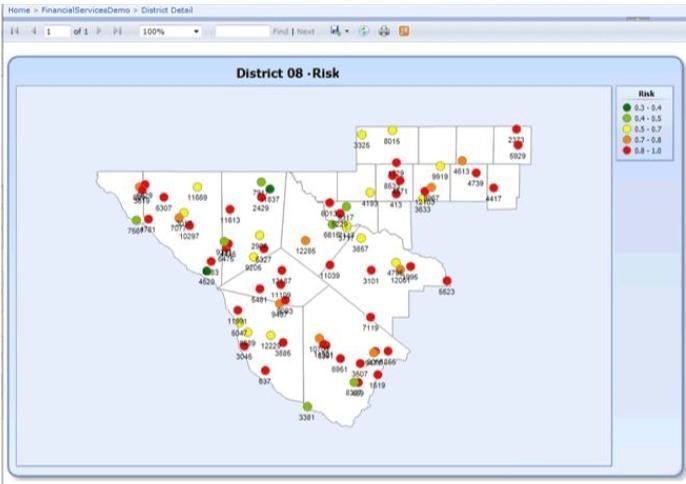
You need to ensure that the report displays only a user selected map region.
Which source of spatial data should you use for the map?
A. SQL Server spatial query
B. Map gallery
C. ESRI shape file
D. Bing Maps layer